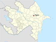
Agsu (Ağsu) is a region in central Azerbaijan. According to geographical situation, Agsu district is located at the bottom of the Great Caucasus and on the plain of Shirvan. 16 villages, 3 territory units are mountainous zone. Its territory is 1020 km2, population in 69.4 persons. There are a city (Agsu city), 78 villages. These dwelling areas are embraced by 24 territorial representations and 60 municipalities. Gagali, Kendoba, Calva, Pirhassanli, Bidzho, Dzhalayir, Padar, Arabushagi and Garagoyunlu are the greatest villages of the district. Agsu district is agricultural district. Cattle-breeding, grain-growing, cotton-growing, fruit-growing and vegetable-growing are the most important fields of the district’s economy. 75.2% or 76742 hectare of its territory is useful for agriculture, 46.3% or 35550 hectare of it is consisted of arable land. Economy of the district is arranged by the agricultural activity. In 2007, total output of the district was 55879.9 thousand manats, and 36685.8 thousand manats or 66 per cent falls to agriculture’s share. Vegetable products of 21644 thousand manats, cattle-breeding products of 15042 thousands manats were produced in the district.